GeoJunxion’s Health Alert Zones API returns relevant information regarding the social impact of epidemics and pandemics based on the provided numerical coordinates of a location. The information includes metrics on cases, deaths and trends a.o.
The first implementation of this API focused on the COVID-19 pandemic.
For countries with a more detailed COVID-19 implementation (see COVERAGE), the returned information includes a risk score, which is determined algorithmic-ally based on the virus- and local business density information a.o. Using this risk score, users can be helped to reduce the risk of potential infection by the coronavirus, or businesses can be assisted in a more safer planning of their logistics operations.
For the development of the COVID-19 part of the Health Alert Zones API, the GeoJunxion team has joined forces with the GeoHealthApp team in their effort to develop an app for helping users to reduce the risk of potential infection by the coronavirus.
KEY FEATURES
• Determines user risk of infection using current location
• COVID-19 data is updated on daily basis
• Uses business density a.o. for calculating the risk score
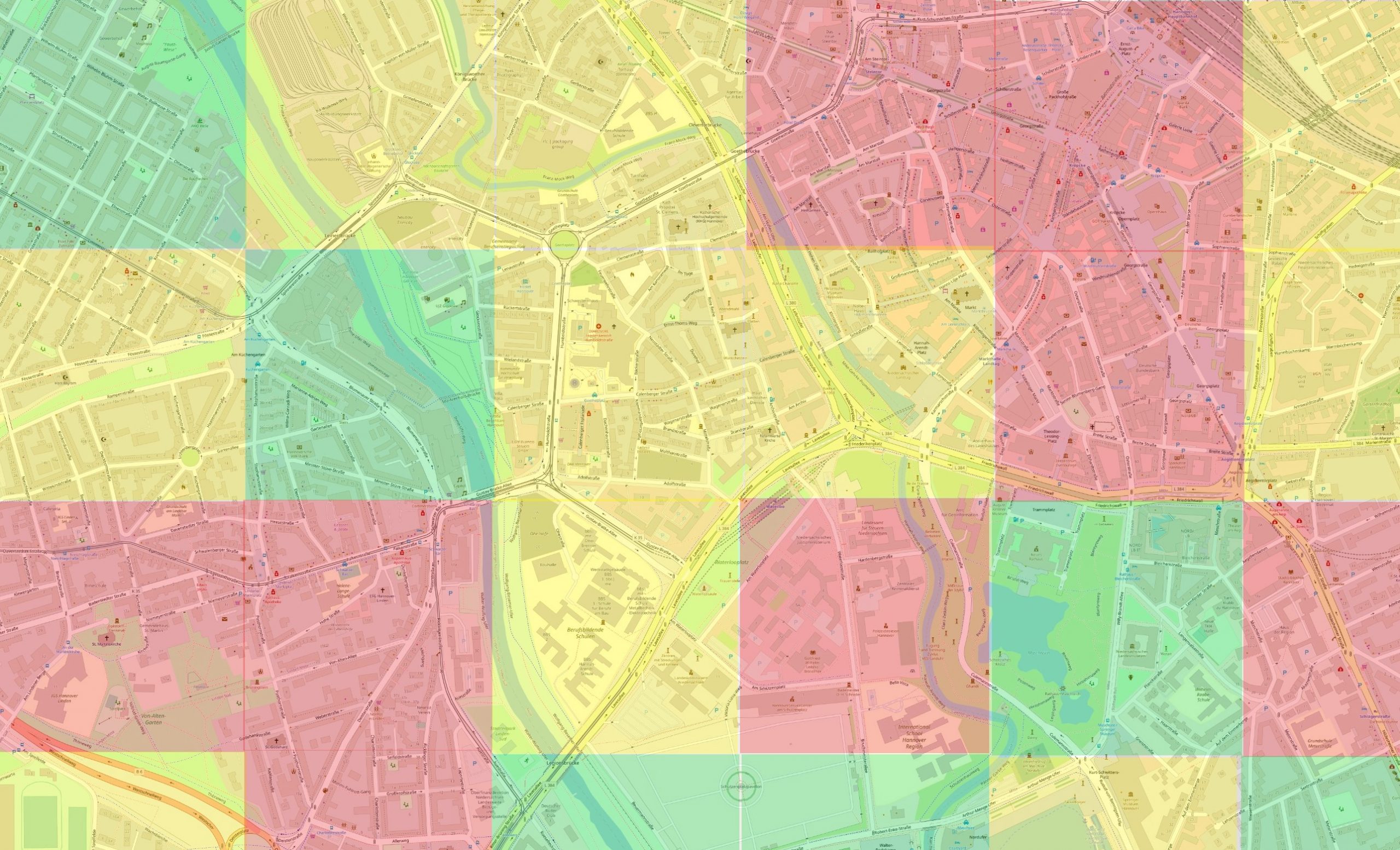
• For a better local risk score, the world is divided in local tiles with an approximate size of 500 square meters
TYPICAL USE CASES
It gives a COVID-19 risk score for a specific area, in order to advise a user whether his or her destination is located in a safe area or not. The user can then make a more informed decision about his or her travel plans. Also businesses can benefit from the risk score feature, since they can use it to make their logistics operations safer by knowing the status of a certain destination and act upon it with appropriate safety measures.
BENEFITS
• Global and local risk exposure information
• Most up to date information about a specific location
• Assists on making a decision regarding taking preventive measures alongside social distancing to minimize risk
PROJECTION
The global projection system used in GeoJunxion data is in decimal degrees (latitude and longitude) with WGS84 as datum, according to the ellipsoid model used for computations. Its spatial reference id is EPSG:4326.
CHARACTER SET
The Unicode character-set used in the names, is in UTF-8.
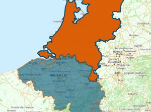
COVERAGE
Global coverage of country level COVID-19 information.
Detailed local level COVID-19 information including risk scores available in Germany, Switzerland, UK, USA, The Netherlands, Belgium, France and Italy.
Getting started
With an API key you will be able to access the related API and if applicable your usage will be automatically tracked and billed. Just click on the “GET YOUR FREE API KEY” button above, to apply for a free trial. Your API key will be between 30 and 128 characters long.