


GEOCODER
The GeoJunxion Geocoder is a powerful geo-location tool for transforming a postal address into numerical coordinates, and even validating the address entered.

ZIP +4 US
With thousands of zip codes changes happening every year, it is important to make sure you regularly update your zip code data with our GeoJunxion ZIP +4 API.
TIME DISTANCE MATRIX
Our Time Distance Matrix is a high performance pre-planning (1000*1000) matrix API which supports ERP optimization by reducing transportation cost and improving asset utilization.
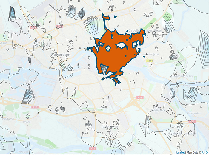
ADMINISTRATIVE BOUNDARIES
GeoJunxion’s Administrative Boundaries are accurate representations of all
the administrative levels within a country. These are available from the
country level down to the most detailed municipality level.

MAP TILE SERVER
GeoJunxion offers a Map Tile Server with GeoJunxion proprietary AND Digital Maps, OpenStreetMap Data or Aerial/Satellite Imagery. This service comes with on-demand tile rendering, often with smart-tiling, and custom styling.
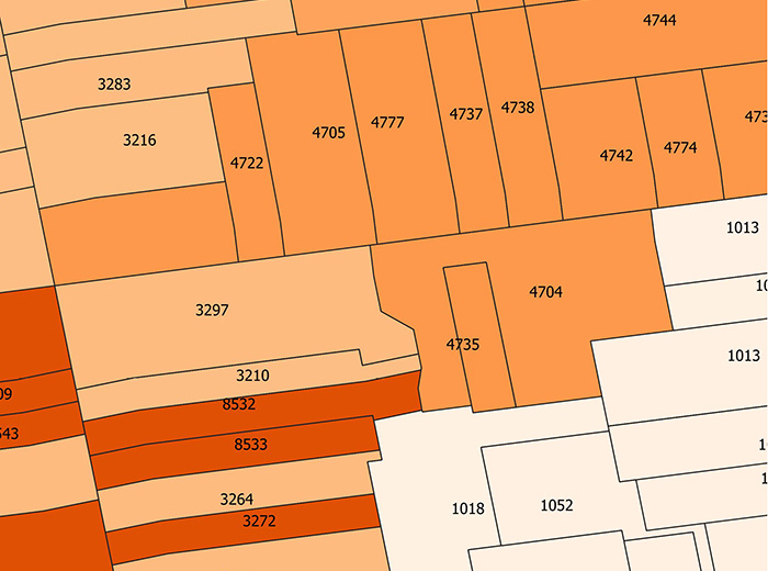
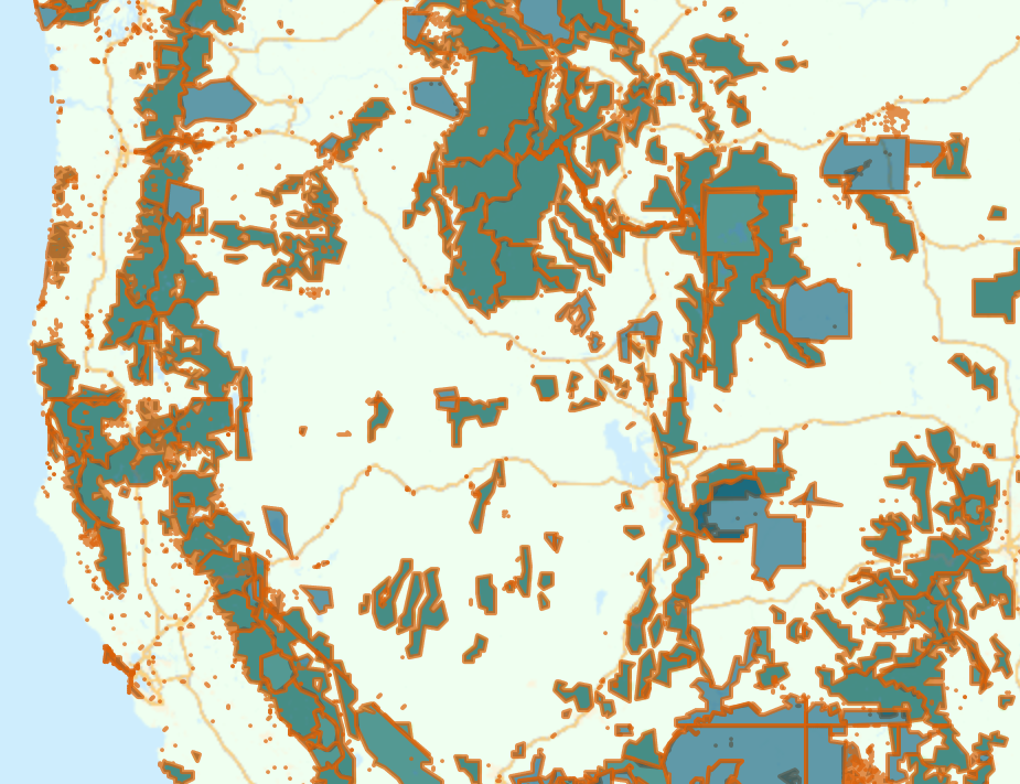
GEO-BOUNDARIES API
The GeoJunxion’s Geo-Boundaries API adds relevant information to a location, based on its numerical co-ordinates – usually the name or type of area. These areas can either be manmade (i.e industrial zones) or natural (i.e. forests or beaches).
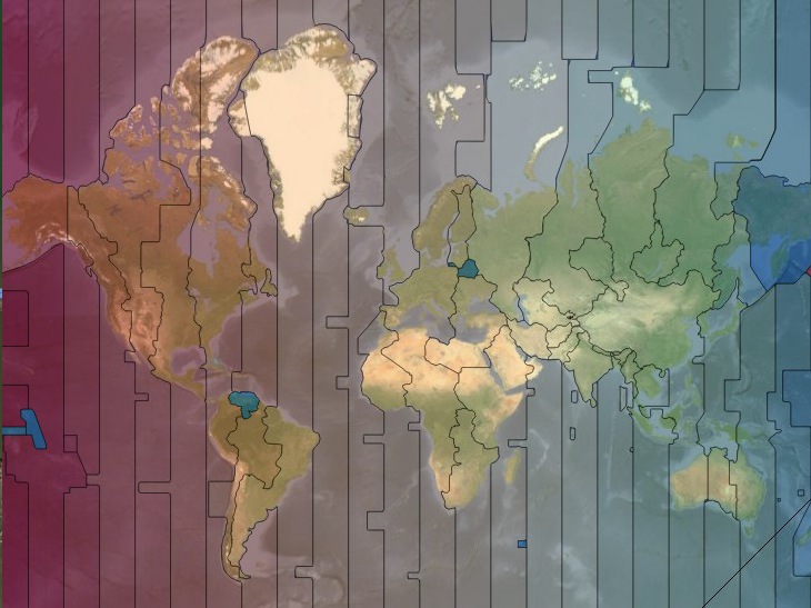
TIME ZONES API
The GeoJunxion Time Zones API provides Time Zone information and reflects the different zones around the globe that observe a uniform standard time based on their location on the surface of the earth.
HEALTH ALERT ZONES
GeoJunxion’s Health Alert Zones API returns relevant information regarding the social impact of epidemics and pandemics based on the provided numerical coordinates of a location. The information includes metrics on cases, deaths and trends a.o.
